Maps and Pictures on Grids Wall Chart
9781920293581
Vendor: Letslook
Couldn't load pickup availability
- Fast Nationwide Delivery
- 100% Quality Guaranteed
- Reliable & Secure Payments
Have a question about this product?
Send us a message and we'll get back to you.
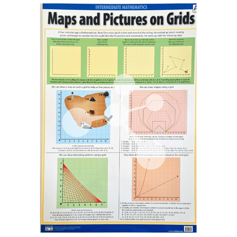
The Maps and Pictures on Grids Wall Chart is an engaging Intermediate Mathematics teaching resource that introduces learners to the fundamentals of coordinate grids, map reading, graphing, and geometric drawing. Designed to support the CAPS curriculum, this educational wall chart uses colourful illustrations and practical examples to demonstrate how grids help us locate positions, draw shapes, and represent mathematical relationships. Ideal for classrooms, tutoring centres, mathematics laboratories, and home learning, this informative poster encourages learners to develop confidence in working with coordinates and graphical representations.
The chart begins with an introduction to the Cartesian coordinate system, inspired by René Descartes. Learners are shown how horizontal and vertical axes are created and how coordinates are written using ordered pairs. A sequence of diagrams illustrates how points are plotted on a grid and how movement across the grid is represented using x and y coordinates, helping learners understand the foundation of coordinate geometry.
A practical map activity follows, using a grid to locate familiar landmarks such as a lighthouse, treasure chest, tree, boat, bird, and hut. Learners can identify the coordinates of each object, reinforcing spatial awareness and demonstrating how grid references are used in real world navigation and map reading.
The wall chart also explains how geometric shapes can be accurately drawn using coordinates. Step by step examples show how polygons including triangles, rectangles, hexagons, octagons, and decagons are created by plotting points and joining them in sequence. This section helps learners understand the relationship between coordinates and geometric construction while improving graphing skills.
Additional activities demonstrate how grids can be used to create interesting line patterns and investigate mathematical relationships. The final section introduces graph plotting by comparing straight line and curved graphs, showing how ordered pairs generate different graphical patterns and encouraging learners to explore their own mathematical rules.
This educational poster is an excellent visual reference for teaching coordinate geometry, map skills, graph interpretation, and geometric drawing. Its clear explanations, colourful diagrams, and practical examples make it an invaluable mathematics resource that supports problem solving, logical thinking, and spatial reasoning.